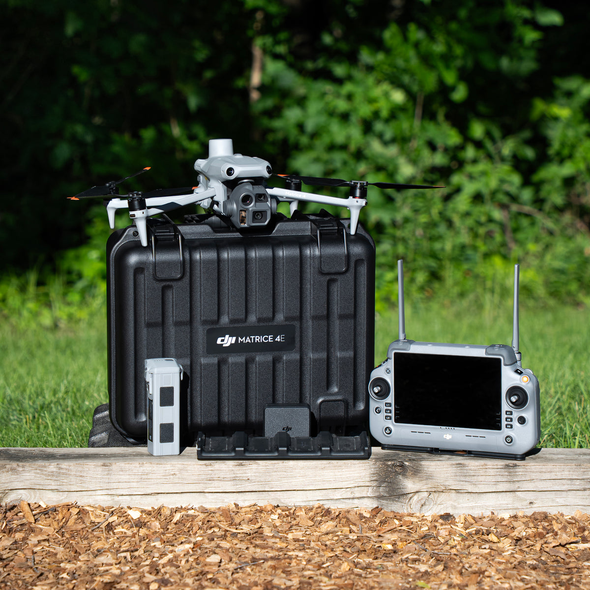
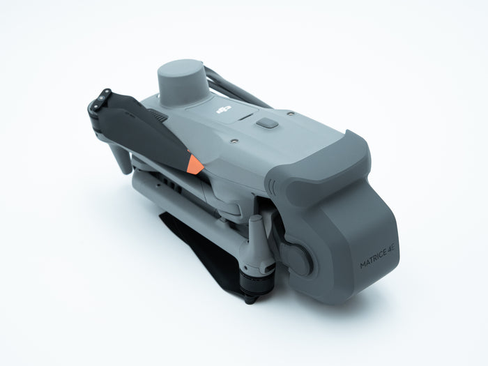
DJI Matrice 4E Survey Drone
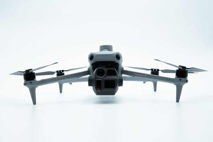
The Matrice 4E is DJI's compact mapping workhorse: a 4/3" mechanical-shutter camera, two 48 MP zoom cameras and a laser rangefinder in one fold-up airframe. This kit has everything you need to start flying survey and mapping missions on day one.
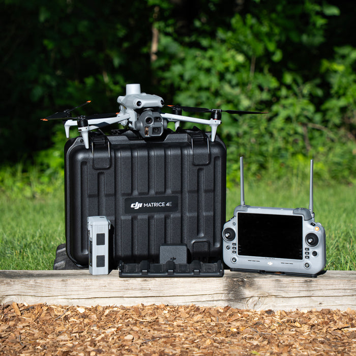
This package includes:
- DJI Matrice 4E aircraft
- RC Plus 2 Enterprise controller
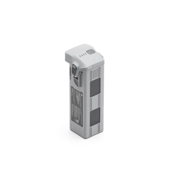
- 1 flight battery
- Battery charging hub
- 100W power adapter
- USB-C data cable
- Hard storage case + strap
- Spare propellers
- Gimbal protector
Choose your setup
Get exactly what your crew needs
Both packages fly the same Matrice 4E. Need more time in the air? Mission Ready adds three extra batteries and fast charging.
M4E Survey Drone
- Matrice 4E + RC Plus 2 Enterprise
- 1 flight battery + charging hub
- Hard case, spare props, cables
- Best for: new operators, shorter missions
M4E Mission Ready Package
- Everything in the Survey Drone
- 3 extra batteries (4 total)
- LKTOP 200W fast charger
- WB37 hub + 2 controller batteries
- Best for: full-day mapping & survey work
What's included in the
Matrice 4E Survey Drone
- Up to 49 minutes of flight per battery
- Add batteries any time, or step up to Mission Ready


Accessories
-

 Vendor:TerraXplore
DJI AS1 Speaker
Regular price $290.00Sale price $290.00 Regular priceUnit price per -

 Vendor:TerraXplore
DJI AL1 SpotLight
Regular price $430.00Sale price $430.00 Regular priceUnit price per -

 Vendor:TerraXplore
DJI Matrice 4 Series Battery
Regular price $259.00Sale price $259.00 Regular priceUnit price per -

 Vendor:TerraXplore
Manifold 3
Regular price $1,999.00Sale price $1,999.00 Regular priceUnit price per -

 Vendor:TerraXplore
DJI Manifold 3 Accessory Kit for Matrice 4 Series
Regular price $99.00Sale price $99.00 Regular priceUnit price per -

 Vendor:TerraXplore
WB37 External Remote Controller Battery
Regular price $83.00Sale price $83.00 Regular priceUnit price per -

 Vendor:TerraXplore
WB37 Battery Charging Hub
Regular price $87.00Sale price $87.00 Regular priceUnit price per -

 Vendor:TerraXplore
DJI Matrice 4 Series Propellers
Regular price $30.00Sale price $30.00 Regular priceUnit price per -

 Vendor:TerraXplore
LKTOP 200W Matrice 4 series Multi Charger
Regular price $200.00Sale price $200.00 Regular priceUnit price per


The Matrice 4E Highlights
Built for survey, construction and mining crews who need accurate data on the first flight.
Why the M4E
Full of survey-grade tech
Everything a mapping crew needs, packed into an airframe that folds into one case.
4/3" Mechanical Shutter
A 20 MP 4/3-inch wide camera with a mechanical shutter avoids rolling-shutter distortion for cleaner orthomosaics.
Read more
Shoots JPEG or RAW (DNG) with an adjustable f/2.8–f/11 aperture, so you can get sharp exposures in bright sun or overcast light.
0.5-Second Capture
A 0.5 s minimum photo interval lets the M4E fly mapping missions faster without losing overlap.
Read more
Fewer passes per site means more acres per battery and less time on the job.
Three Cameras, 112× Zoom
Wide, 70 mm medium tele and 168 mm tele cameras combine for up to 112× hybrid zoom.
Read more
Both zoom cameras are 48 MP, so you can inspect structures and read details from a safe distance without repositioning.
Laser Rangefinder
Measure the distance and location of targets up to 1,800 m away, right from the controller.
Read more
Handy for quick site checks, marking points of interest and sharing coordinates with the crew on the ground.
RTK Ready
Add the RTK module for centimeter-level accuracy: 1 cm + 1 ppm horizontal, 1.5 cm + 1 ppm vertical.
Read more
Cut down on ground control points on many jobs and get survey-grade results faster.
Omnidirectional Sensing
Vision sensors on every side plus a downward 3D infrared sensor help the aircraft brake or reroute around obstacles.
Read more
Fly near structures, tree lines and equipment on active job sites with more confidence.
How does it stack up?
Matrice 4E vs. Matrice 4T
Same airframe, different mission. Here's how to pick.
| DJI Matrice 4E | DJI Matrice 4T | |
|---|---|---|
| Best for | Mapping, surveying, construction, mining | Public safety, search & rescue, thermal inspection |
| Wide camera | 20 MP 4/3" with mechanical shutter | 48 MP 1/1.3" (electronic shutter) |
| Zoom cameras | 48 MP 70 mm + 48 MP 168 mm | 48 MP 70 mm + 48 MP 168 mm |
| Thermal camera | — | 640×512 (1280×1024 super-resolution) |
| RAW photos | Yes (DNG, wide camera) | JPEG only |
| Min. photo interval | 0.5 s | 0.7 s |
| Laser rangefinder | 1,800 m | 1,800 m |
| Max flight time | 49 min | 49 min |
| Transmission | O4 Enterprise, up to 15.5 mi (FCC) | O4 Enterprise, up to 15.5 mi (FCC) |
| Drone kit price | $5,199 | $6,899 |
Specifications
Technical Specifications
Common questions
M4E FAQs
What's the difference between the Survey Drone and Mission Ready?
Both include the same Matrice 4E and RC Plus 2 Enterprise controller. The Survey Drone comes with 1 flight battery and a charging hub. The Mission Ready Package adds 3 extra batteries, the LKTOP 200W fast charger, a WB37 charging hub and 2 WB37 controller batteries for full days in the field.
Should I get the 4E or the 4T?
Choose the 4E for mapping, surveying, construction and mining, where the mechanical-shutter camera matters most. Choose the 4T if you need thermal imaging for public safety, search and rescue, inspections or wildlife recovery.
Do I need a license to fly the M4E commercially?
Yes. Commercial flights in the U.S. require an FAA Part 107 Remote Pilot Certificate. Our team can point you to training resources.
What mapping software works with the M4E?
Plan missions in DJI Pilot 2 on the controller and process data in DJI Terra. DJI FlightHub 2 is also supported for fleet management, along with many third-party mapping platforms.
Does the M4E support RTK?
Yes. Add the Matrice 4 Series RTK module for centimeter-level positioning (1 cm + 1 ppm horizontal) and fewer ground control points.
Can I trade in my current drone?
Yes. TerraXplore accepts any make and model drone as a trade-in toward a new drone. Fill out the trade-in form and we'll send you a valuation.
How long does shipping take?
In-stock orders ship same day, and shipping is free on all drones. Questions? Call us at (888) 867-8986.
Not sure which package fits your jobs?
Talk to a TerraXplore drone specialist. We'll help you build the right setup.